Sunday, October 22, 2006

Route No. 4 Ride Postponed

Hi All!
Sorry for the late notice, but we've decided to postpone our ride of Route No. 4 for today due to weather. We'll let you all know when we decidee on a time to reschedule. Thank you for your interest and we hope to see you next time!

- Jennifer

Monday, October 16, 2006

Route 4 Sunday!

When: Sunday, October 22, 1PM
Where: Fred Fletcher Park
What: Raleigh Route #4!
Why: Because its fun!

Hi All! The Raleigh Bike Route Rides group just keeps on truckin'... we've made it past Bike Routes 1 - 3, and this Sunday we'll be riding Bike Route No. 4. In order to avoid State Fair traffic, we'll meet at Fred Fletcher Park at 1 PM, and ride from there to the route, which is located in the neighborhoods south of Beryl Road. As usual, we'll be taking pictures of the conditions along the route (and any fun things we see too), and afterwards we'll go somewhere to catch a bite to eat.

Route 4 should be about 5 - 6 miles, making for an entire round trip of about 10 - 12 miles. For a map of the ride, see here. This ride is intended to be fun and open to people of all skills and ages. We welcome both newbies and experts! As with Routes 1 - 3, this ride is part of a series of rides intended to explore all of the bike routes in Raleigh. It's a fun ride, so it's no drop and we're going fairly slow. Along the way, we're taking pictures of neat things we see, some of the conditions on the ride, and of course, any goofiness. Eventually, our goal is to do all 13 bike routes by the end of the year (for a route map, see here.). You can check out our adventures so far at raleighrides.blogspot.com.

For more information, or if you're interested in coming and want to make sure we wait for you at a particular stop along the way, feel free to contact me at raleighroutes@hotmail.com.

We hope to see you there!

Route 3: Ridge Road and Beyond

We rode Route 3 on Sunday, October 15th, as planned. The entire route took little less than an hour (maybe even more like half an hour), and was about 5.35 miles long. It took us down Ridge Road, which has a nice wide striped shoulder/bike lane for most of it, and then on into the neighborhoods north of the Quail Ridge Shopping Center.

We started our ride at the intersection of Ridge Road and Leonard Street, where we all posed for the camera:


Not shortly thereafter, we encountered this:


Cars ARE allowed to park in the bike lane/shoulder/whatever it is on the weekends, but you can imagine what it must be like if it were a weekday.

Overall, the ride took us through some beautiful neighborhoods, and was quite pleasant. There was some debris in the bike lane/shoulder on Ridge Road, and also some bumps in the road where the asphalt was heaving that were pretty jarring to ride over. Nothing too dangerous, just surprising. The ride along Banbury Road next to the linear park was particularly pleasant, especially because it was shaded and had some greenery, although there might have been some better signage to indicate which bike route we were on if we didn't have a handy map.

At the end of the ride, some of us headed to Whole Foods for some healthy refreshments. Compared to Bike Route 2, this ride was a piece of cake!

Thursday, October 12, 2006

Route 3 this weekend!

When: Sunday, October 15, 1PM
Where: Whole Foods/Quail Ridge Shopping Center off of Wade Ave, meet near the ATM next to All-Star Bikes
What: Raleigh Route #3!
Why: Because its fun!


Hi All! It's time again to check out another one of the City of Raleigh's bike routes! This weekend we will be hitting Bike Route No. 3, which is the route behind the Quail Ridge/Whole Foods Shopping Center off of Wade Ave. We will meet at 1PM this coming Sunday, Oct 15, in the Quail Ridge/Whole Foods Shopping Center near the ATM next to All-Star Bikes. From there, we'll ride the route, taking pictures and having fun as we go, and then we'll stop and get food from Whole Foods afterwards. This ride is intended to be fun and open to people of all skills and ages. We welcome both newbies and experts!

As with Route 2, this ride is part of a series of rides intended to explore all of the bike routes in Raleigh. It's a fun ride, so it's no drop and we're going fairly slow. Along the way, we're taking pictures of neat things we see, some of the conditions on the ride, and of course, any goofiness. Eventually, our goal is to do all 13 bike routes by the end of the year (for a route map, see: http://dotw-xfer01.dot.state.nc.us/gisdot/DOTBikeMaps/_Raleigh/raleigh-front-sm.jpg). So far, a group has already ridden Bike Route No. 1 and 2, and you can check out our adventures at raleighrides.blogspot.com.

For more information, or if you're interested in coming and want to make sure we wait for you at a particular stop along the way, feel free to contact me at raleighroutes@hotmail.com. I hope to see you there!

Sunday, October 01, 2006

Route 2: North Hills

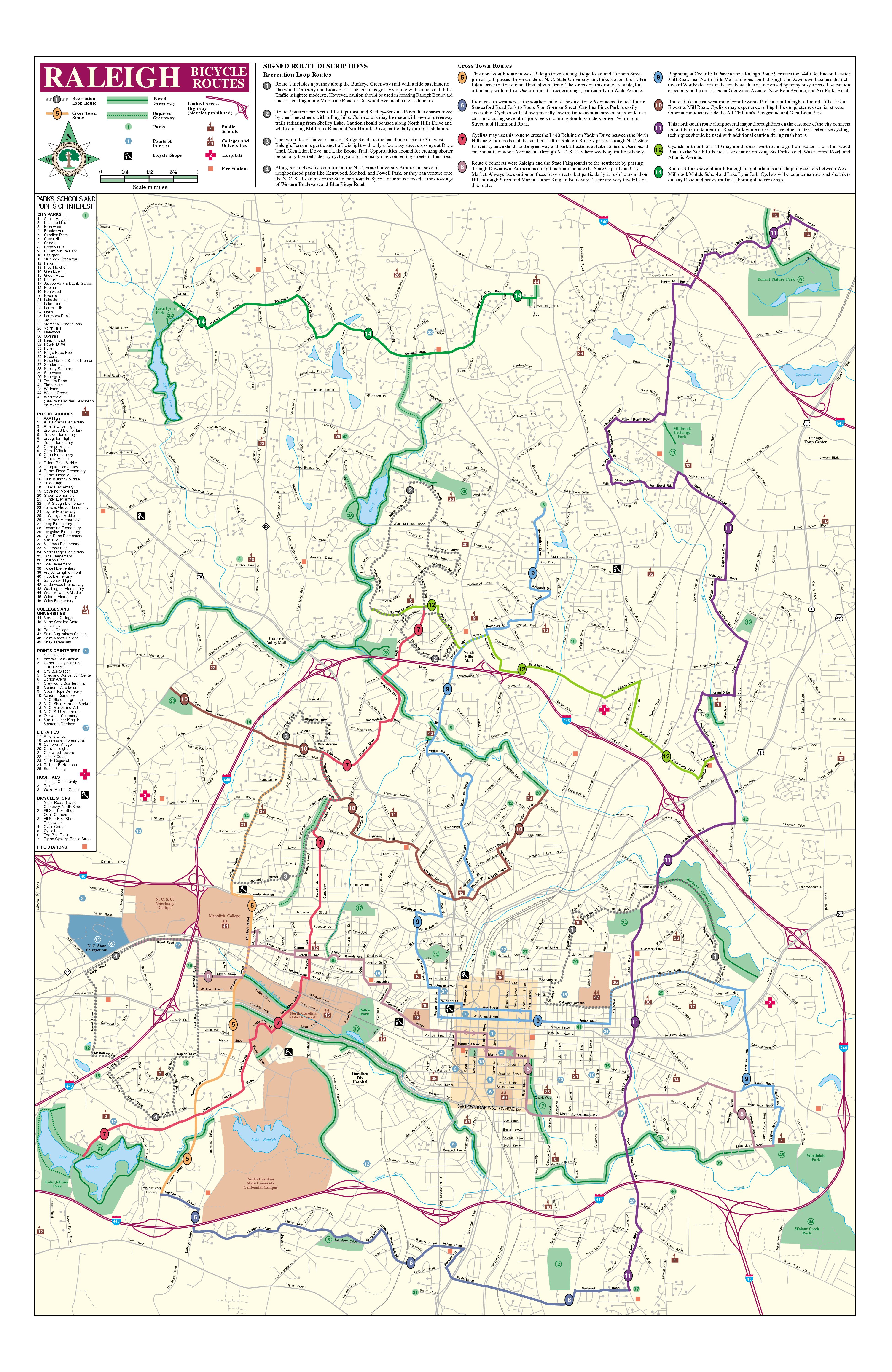
This Sunday, Oct. 1, we finished Route 2. Wow! What a turn-out! And what a ride it was! We had 10 people, including 3 year old Ben. The route was a little over 5.7 miles. Thanks to Sam and the power of ped-google, I was also able to calculate the entire RIDE, which went from Fred Fletcher Park near Cameron Village, to Bike Route 2, around Bike Route 2, and then back to Fred Fletcher Park, and eventually the smoothie place on Hillsborough (the name of which I've forgotten now, but if anyone knows it, please remind me because those smoothies were goooood). This turned out to be more like about 15 or 16 miles, including about 300 feet of climbing and descending. Along the way, we learned that, apparently, there is a reason why it's named North Hills... because there are some HILLS.

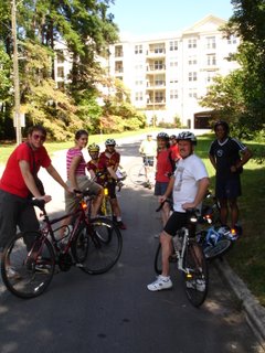
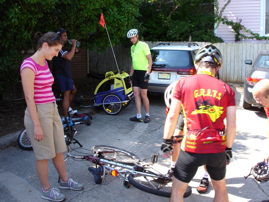
Here are some pictures of us at the start of our ride at Fred Fletcher Park.


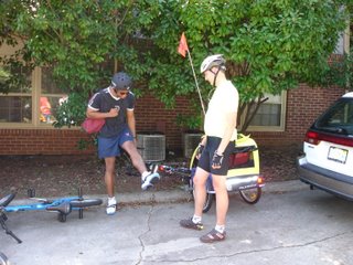
As you can see, our variety of bikes now extends to road bikes, mountain bikes, a BMX bike, a tandem, and Steve with Ben in the buggy in back. Who knows what we will have next?

Our adventure first began with a little confusion traveling to North Hills itself. Initially we wanted to take Route 9, but we got a little lost getting from Harvey Street to White Oak Road. We got back on track, but we think there might be some signage issues in there that may have contributed to our confusion. We also had trouble turning on to Lassiter Mill Road from White Oak Road - the light wouldn't change for us. Maybe we need a bike sensor there?

Once we were finally on our way, we encountered THE HILL. Which by the way, is on Lassiter Mill Road from Marlowe to Pamlico leading up to North Hills. It was pretty intense. We had to take some breaks.


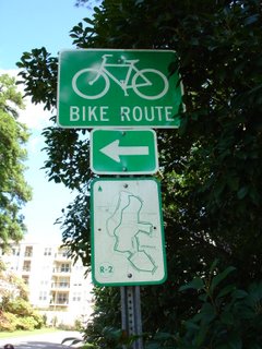
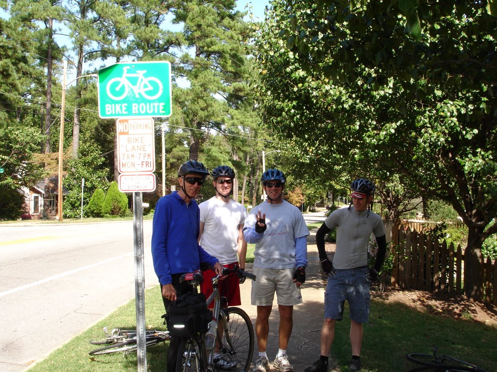
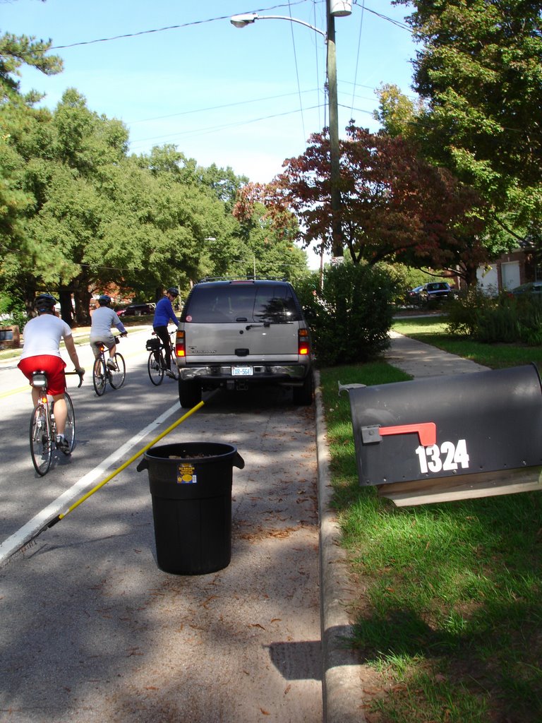
But we all finally made it, and passed over I-440 to the neighborhoods behind North Hills, where we started the actual route:


Route 2 stays in a primarily residential area, which means that the roads have low traffic volumes, traveling at low speeds, and are pretty well-kept up (not a lot of debris in the way). We also passed two elementary schools, North Hills Country Club, and cut close to Optimist Park and Shelley Lake. There was some construction at the North Hills Country Club that left a big pothole in the road - I took a picture but I think it will go away with the completion of the construction. At West Millbrook and Dixon, we had trouble triggering the light with our bikes for us to pass, but then coming back at West Millbrook and North Hills Drive, the light changed right away for us.

When we finally finished the route, we still had the ride back to Fred Fletcher Park to go, so we took St. Mary's straight there.

We then headed for some well-deserved Smoothies, which were MmmMMmm, Good.

With all the hill-climbing and distance riding, this was probably the most intense ride yet. We took lots of breaks, but the hills were pretty steep so I'm proud that we finished so much! We will definitely be prepared for Route 3 coming up!